 vesseltracker.com
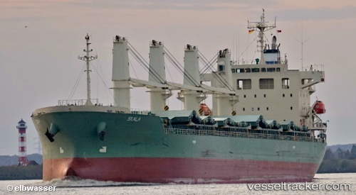
Vessel V LYRA IMO: 9539444, MMSI: 352005418 Bulk Carrier
UTC, -19.93684, 118.56742, course: 353, speed: 1.4
UTC, -19.93679, 118.56672, course: 50, speed: 0.5
2026-03-05 17:58:01 UTC, -19.93537, 118.56571, course: 92, speed: 0.1
Live Vessel V LYRA Analytics (details, animations, etc.)
Live AIS position: UTC. 22 nm N of Port Hedland), updated 2026-03-05 17:58:01 UTC.Find the position of the vessel V LYRA on the map. The latter are known coordinates and path.
marine traffic ship tracker show on live map
The current position of vessel V LYRA is -19.93537 lat / 118.56571 lng. Updated: 2026-03-05 17:58:01 UTCCurrently sailing under the flag of Panama
Details:
Last coordinates of the vessel:
UTC, -20.07407, 118.55343, course: 6, speed: 8.4UTC, -19.93684, 118.56742, course: 353, speed: 1.4
UTC, -19.93679, 118.56672, course: 50, speed: 0.5
2026-03-05 17:58:01 UTC, -19.93537, 118.56571, course: 92, speed: 0.1